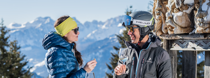
Panorama path

Add to favourites
Category
Difficulty
Easy
Duration
0:53
in hours
Distance
2.7
in km
Status
open

The Panoramweg starts at the bus stop near the App.Hotel Winklwiese, which you can easily reach with Skibus No. 21 or Citybus No. 435.1. This walk takes you through the snowy meadows and fields of Oberolang and Mitterolang, offering a stunning view of Mitterolang. The path continues past the "Spitziges Stöckl," and after about 1 hour and 2.7 km, you’ll arrive in Niederolang, the end of the trail. From Niederolang, you can easily take the Skibus or Citybus back to Mitterolang, Oberolang, or Geiselsberg.

Route data
Easy
Distance
2,7 km
Duration
53 min
Ascent
16 m
Decent
73 m
Highest point
1.118 m
Lowest point
1.047 m
You might be interested in
Discover related tours
Winter hike Seefelder
Distance 1,7 km
Duration 28 min
Ascent 15 m
Decent 8 m
Status
open
Bild | © TV Olang, Olang
Intermediate
Add to favourites
Olang/Valdaora
Walk Olang - Welsberg
Distance 6,1 km
Duration 1 h 35 min
Ascent 65 m
Decent 53 m
Olang/Valdaora
Hike Valdaora – Lago di Braies/Olang – Pragser Wildsee
Distance 11,7 km
Duration 4 h 57 min
Ascent 1.184 m
Decent 767 m
Olang/Valdaora
Concordia Panorama Trail
Distance 2,0 km
Duration 1 h 00 min
Ascent 30 m
Decent 30 m
Dolomites view | © Tourismusverein  Antholzertal, Tourismusverein Antholzertal
Intermediate
Add to favourites
Olang/Valdaora
Dolomites panoramic view tour
Distance 9,1 km
Duration 2 h 58 min
Ascent 555 m
Decent 555 m
Status
closed
Dolomites | © Skirama Kronplatz, Bruneck Kronplatz Tourismus
Intermediate
Add to favourites
Olang/Valdaora
Plan de Corones > Pracken > Malga Oberegger > Casola
Distance 8,3 km
Duration 3 h 30 min
Ascent 0 m
Decent 1.119 m
Status
closed